| Home Welcome |
world
| DEVELOPMENT DRAFT The only stable URL is http://www.vendian.org/howbig/. Comments encouraged - mncharity@vendian.org (Mitchell Charity) |
How Big Are Things?
|
small | Real world |
big | solar system | between | galaxy | ||||||||||||||||||||
| nano |
micro |
meter |
kilo |
Mega |
Giga |
Tera |
Peta |
Exa |
||||||||||||||||||
| kilometer's Room - looking at a sheet of graph paper |
|
look at the entire room |
|
| galaxy | 21 | |
| 20 19 | ||
| local stars | 18 | |
| 17 16 | ||
| between | 15 | |
| 14 13 | ||
| E's orbit | 12 | |
| 11 10 | ||
| sun | 9 | |
| 8 7 | ||
| texas | 6 | |
| 5 4 | ||
| hood | 3 | |
| 2 1 | ||
| you | 0 | |
| -1 -2 | ||
| salt grain | -3 | |
| -4 -5 | ||
| bacteria | -6 | |
| -7 -8 | ||
| atom | -9 |
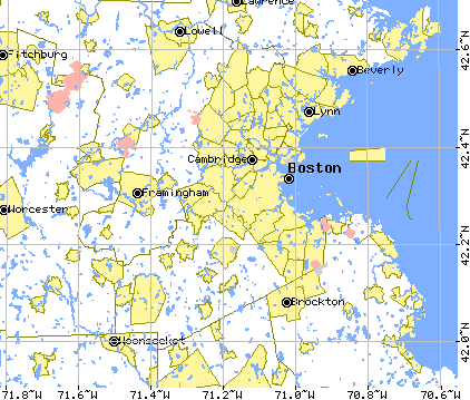
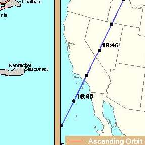
US Census Tiger Map Server
Their "Scale" may not say 1:1000000 because they assume a 75bpi screen.
| miles (mi) | |||||
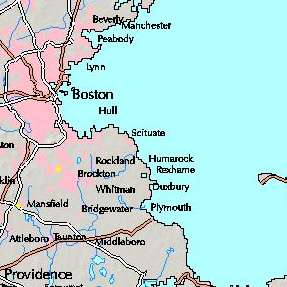    |
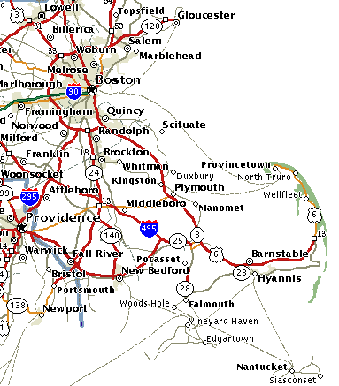 (c) MapQuest.com | |
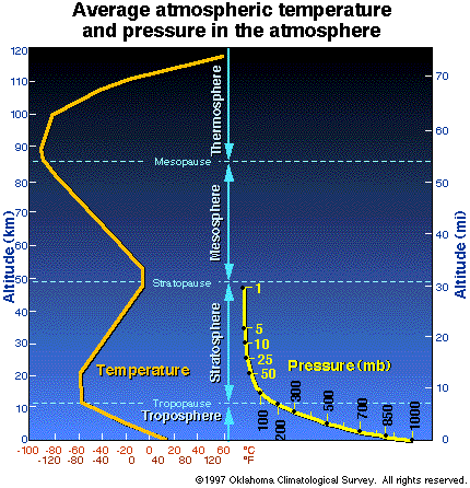
| average atmosphere 10% and 50% pressure heights | |
| crust |
 height heightair pressure |
 temperature |
visible horizon
![]() at eye-height;
at eye-height;
 at 10 m;
at 100 m;
at 10 m;
at 100 m;
(distance to horizon is ~100 × sqrt(height))
src
(neglecting topography of course. eg, in smooth seas)
Wildfire (Arizona, June 2002)
(zoom out 10x)

Image (1 MB) from here. About 300 thousand acres burned. |
106 acres (106 is a million) |
Earth's crust - thickness:
|
Crustal thickness maps: Global, another, 2°; North America; histograms Maximum thickness results from a "double" crust - one plate pushed under another. |
||||||
|
oceanic ~min / ~ave / ~max |
||||||
|
continental ~ave / ~max |
||||||
| atmosphere (ave 10% and 50% pressure heights) mean ocean depth ocean crust (mostly 7±1 km) |
| land height (maximum and average) | |||
| ocean depth (max, ave) | |||
![]() Antartic ice sheet
Antartic ice sheet
| Rule of thumb: atmosphere presure decreases by about 1/3 per 7 km. 1/27 (4%), 1/9 (10%), and 1/3 (30%) |
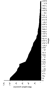
![]() Thumbnail of meter Room floor.
Thumbnail of meter Room floor.
![]()
src,
image
This image is only very roughly aligned with the one below.
source ![]() This diagram stops at sea level - land surface height is not shown. :( Eg, Everest is this
This diagram stops at sea level - land surface height is not shown. :( Eg, Everest is this ![]() high.
high.
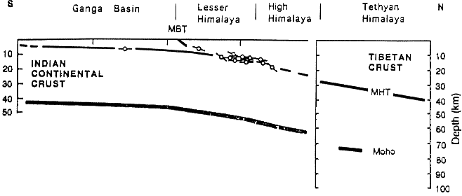
Pacific crust decending under Oregon Info here.
There is a scale map on the floor.
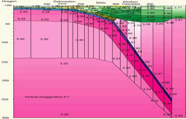 Numbers are density (g/cm^3) - light rock floats higher. You can see the thin blue ocean upper left. <- West, East -> The "-100" depth under "Oregon" is a typo - it should of couse be "0". |
| ... |  |
?...? | |
| neutron star | |||
(c) 2000-2003 Mitchell N Charity. All rights reserved.
Noncommercial use is fine. Otherwise, ask.